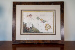
Rare 1798 Cassini Map of The Sandwich Islands (The First Printed Map of Hawaii)
CC-0288 – Rare 1798 Cassini Map of The Sandwich Islands (The First Printed Map of Hawaii)
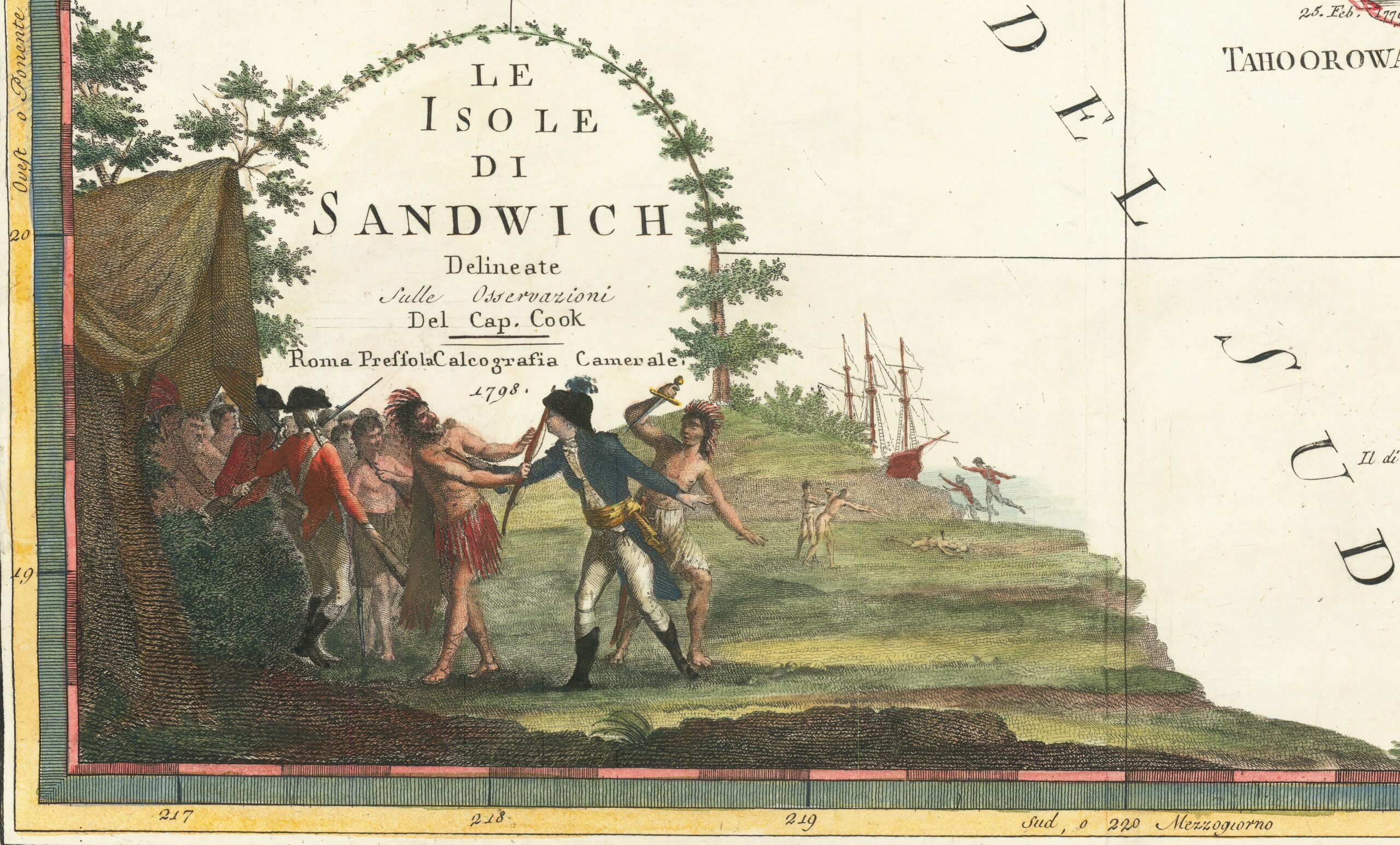
Cartographer: Giovanni Maria Cassini
Published in Rome, Italy in 1798
Map dimensions: Approx. 19” x 14”
Frame Dimensions: 30” x 24-1/2”
Condition: Very Good+
Description: This is an original and rare map of the Sandwich Islands (now known as the Hawaiian Islands) published by Giovanni Maria Cassini in 1798. The splendid cartouche in the lower left corner illustrates the death of Captain Cook on the island of Hawaii in 1779. Captain Cook’s daring voyages and untimely death made this one of the most famous scenes of the late 18th century.
Cassini’s beautiful map of Hawaii is drawn from Captain Cook’s map of Hawaii. Cassini copied Cook’s original map in a larger format that shows Cook’s tracks on a daily basis as he sailed through the island chain.
Cassini however made some interesting errors on his map, including his representation of the Hawaiian natives with feather headdresses, which is actually more reminiscent of the Native American Indians. His other mistake is showing Captain Cook, an English naval officer, in an Italian naval officer’s uniform.
Without question, this map is the most decorative and sought after of all Hawaiian maps and the only decorative map based upon Cook’s voyage to Hawaii.
For more information on the Voyages of Captain Cook, click on the link here
If you would like to see a short video on the history of this map, visit our Instagram page here.
$15,500.00